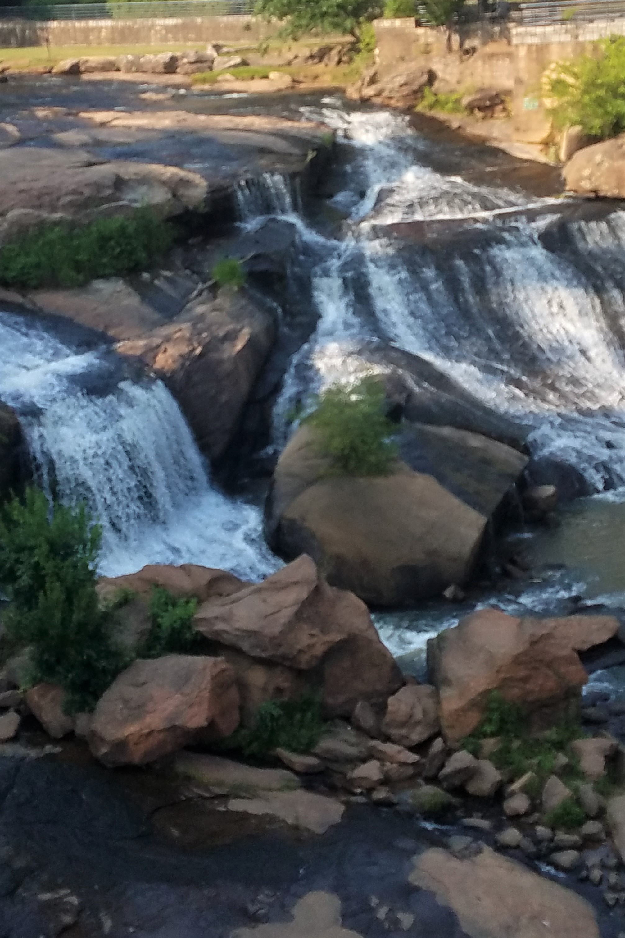
Falls Park, Reedy River, Greenville, NC
My husband Dave and I were on our way to visit his cousin who lives in South Carolina close to the North Carolina border. They had lived in the San Diego and Washington D. C. areas and recently moved to South Carolina to be close to their daughter. I understand why they moved there. The area is beautiful.
After a few wonderful days, we continued on our journey to explore the Blue Ridge Parkway and Shenandoah National Park in Virginia. I was hopeful to add a little genealogy along the way. Many of my ancestors and those of Dave lived in Virginia and North Carolina eventually making their way to Missouri.
Our first stop was Caswell County, North Carolina where my Turner and Vaughn families lived for a period of time. The land was rolling, and we could see that it was perfect for the tobacco that the Turner and Vaughn families most likely grew. Fortunately, I have lots of information about the families, much provided by my second cousin Jean Vaughn Hendricks and supplemented by information found online. I didn’t have time for additional search in the courthouse but wanted to see if we could find the area in which my ancestors lived. From Yanceyville, the county seat, we traveled south on Highway 62 in search of the south fork of Country Line Creek where the Turner’s settled. Thanks to modern technology we were able to determine where the creek intersected the highway. After a few times riding up and down the highway and traveling over the area where Google map showed the creek was located, we realized that it probably ran alongside and through a culvert under the highway. Country Line Creek is a long creek running through the county. I know we weren’t on Turner’s land, but it was interesting to see what the area looked like.
With our destination of the Blue Ridge Parkway still ahead, our trek took us through Gastonia County. It was here the Ferguson’s settled at the base of Crowder’s Mountain, close to King’s Mountain and endured the hardships of the Revolutionary War. It was good to rest our weary bones that night in Lynchburg, Virginia.

View from the Blue Ridge Parkway in Virginia
The next day we awoke to overcast skies and the threat of rain. Oh, no!!! This didn’t bode well for our drive through the Blue Ridge Parkway and the Shenandoah National Park. But like our intrepid ancestors, we pushed on in our comfortable mode of transportation covering many more miles in one day then they were ever able to do. Fortunately, the rain held off while we traveled on the Blue Ridge Parkway. The views were spectacular despite the overcast weather. By the time we entered the Shenandoah National Park, it started to rain steadily. And because National Parks are left in their natural state, it was hard to see the views from the designated parking areas and very disappointing. Midway we left the park and took Highway 11 to our next destination, Toms Brook, in Shenandoah County, Virginia, originally located in Frederick County.
According to Wikipedia, “Valley Pike or Valley Turnpike is the traditional name given for the Indian trail and roadway which now approximates as U.S. Route 11 in the Shenandoah Valley of Virginia.” [1] As we traveled through quaint towns with the Shenandoah Mountains to our right, we saw several historical markers. We learned later this road was used by Stonewall Jackson to march his Confederate troops up and down the valley in 1862 and 1864 during the Civil War.
It is very hard to pinpoint the location of our ancestors in states that used the metes and bounds method of describing the location of their land. Natural landmarks, like trees and watercourses, were used to describe the boundaries of their land. The only deed I have found for my ancestors that pinpointed the location of their land was the one I found for Henry Zumwalt, my 5th great-grandfather. His land was located at the confluence of the Toms Brooks and the north fork of the Shenandoah River.
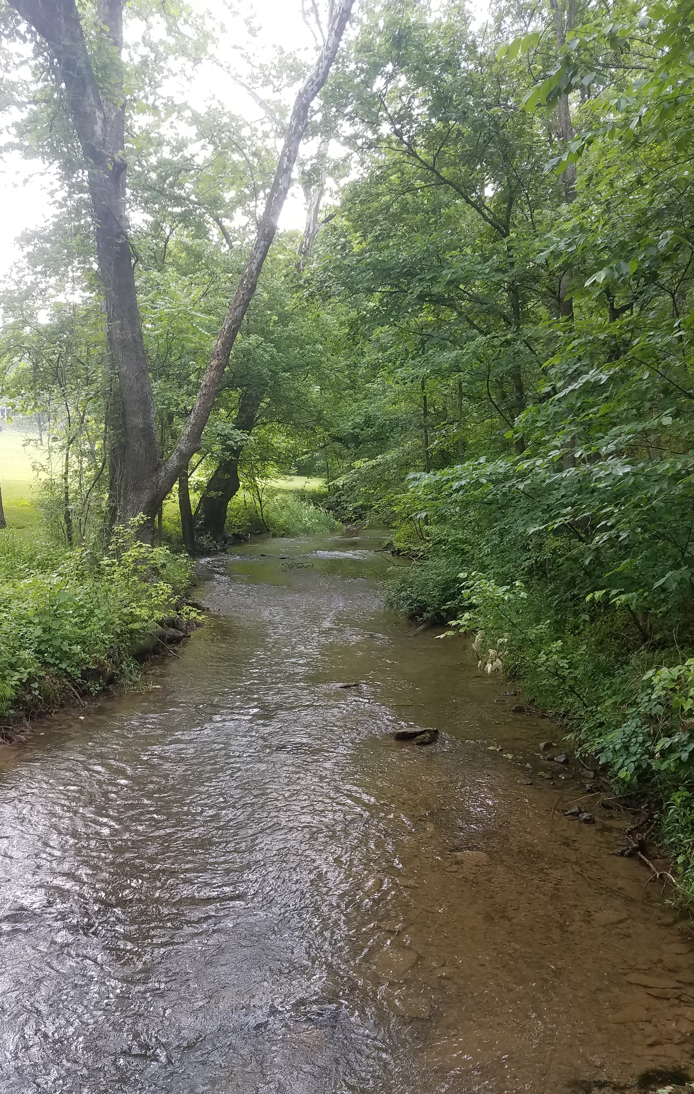
Toms Brook
Again, Google maps to the rescue. Arriving in the small town of Toms Brook on Highway 11, we saw there was a road that paralleled Toms Brook creek and terminated at the north fork of the Shenandoah River. As we traveled along the paved road, we had high hopes that we would step foot on the land owned by Henry. Very quickly the road changed to gravel and the further we traveled the narrower it became. In many instances, we hoped we wouldn’t meet another car on the road because there was nowhere to turn around. Finally, we came to a house at the end of the road.
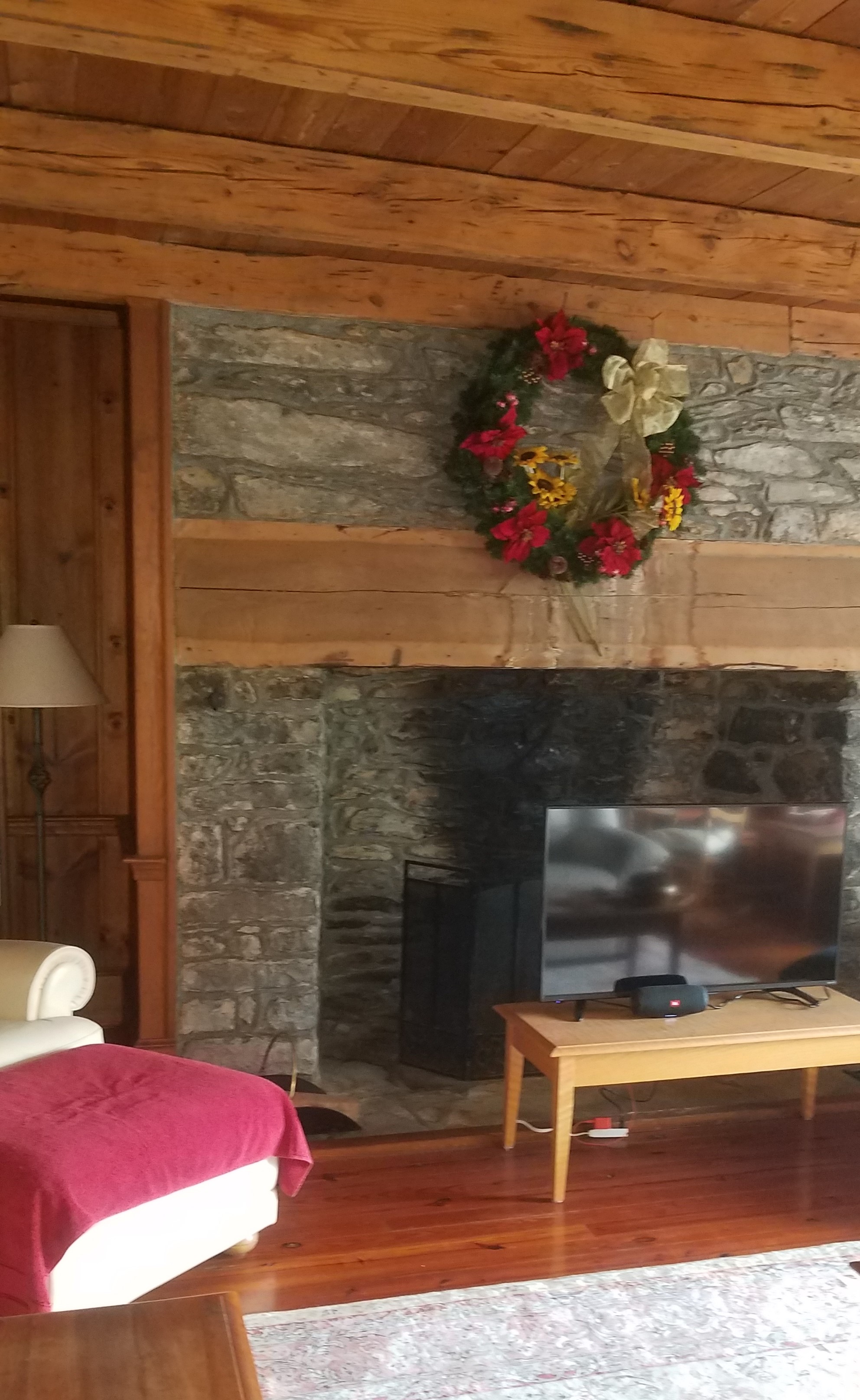
Old Meets New
Gathering courage, I approached the house and knocked on the door. I’m sure the man inside was wondering who would be knocking on his door at dinner time. “Hi, I’m from Missouri,” I foolishly said as he answered the door. I quickly introduced myself and explained that my great-grandfather had owned the land on which his house sat. This kind man invited Dave and me into his house and introduced himself and his wife. I was so excited at the prospect of learning about the land I, unfortunately, forgot their names. He explained a section of the house was certified as being built around 1800 give or take ten years. In this section were the original beams and fireplace. The craftsmanship of the fireplace was phenomenal. The gentleman steered me through the back door of the house and pointed to an area where Toms Brook flowed into the north fork of the Shenandoah. Because of the high brush and light rain, I didn’t walk to the confluence. However, I could see the Shenandoah Mountains in the background. He explained that the course of Toms Brook had never changed because it runs through rock. We thought that Henry may have possibly lived in the house, but there was another cabin on the other side of the creek that may have also been a likely candidate. Unfortunately, this cabin had been torn down. These kind people gave me an experience I will never forget. While we drove back to the main highway, we took our time and stopped at a few places along Toms Brook to savor the peace and quiet of the bubbling brook. We ended our trip with a visit to Harper’s Ferry and the Battle of Antietam the following day.
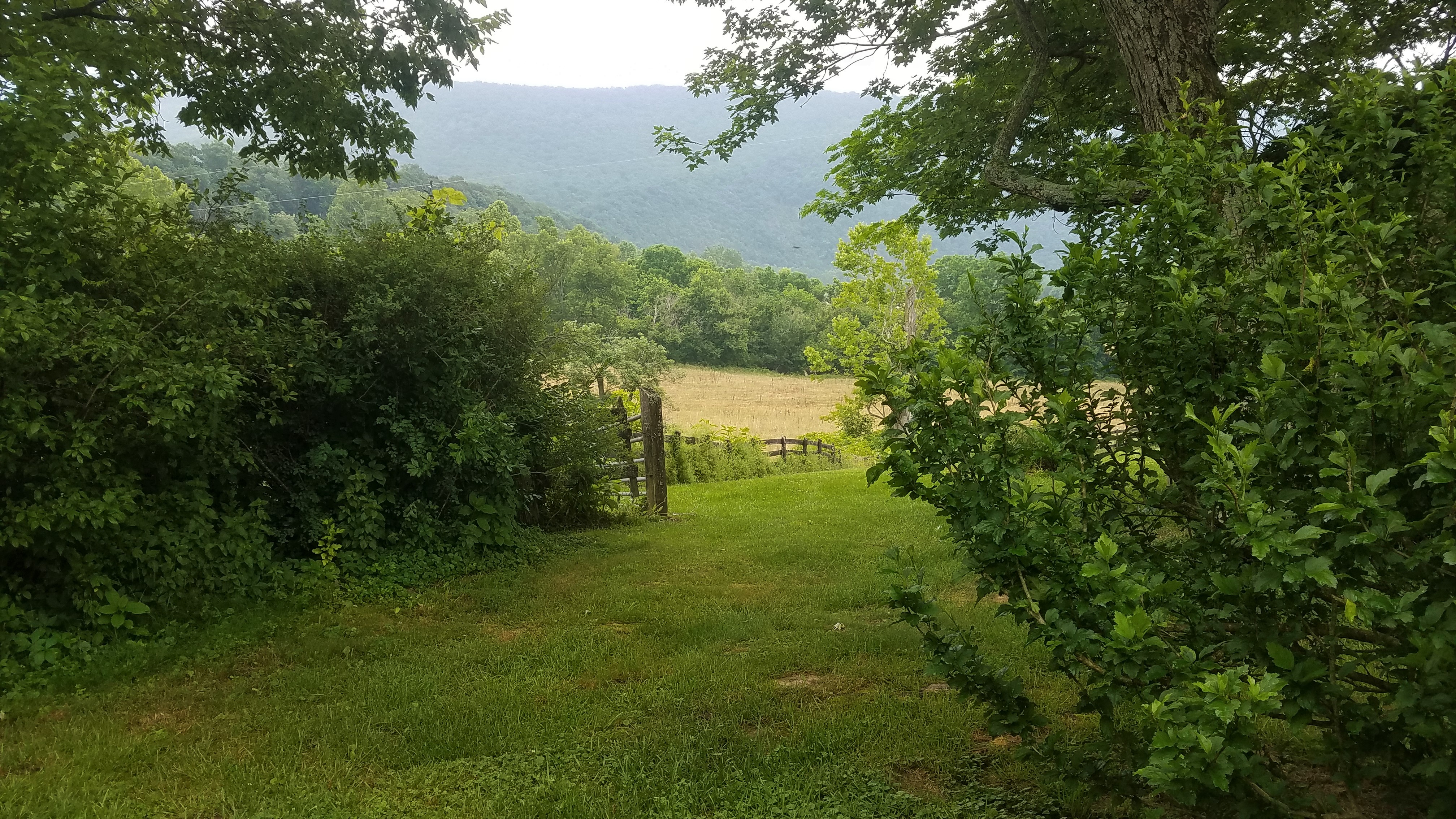
Behind the Tree Line and in the Middle of the Picture Lies the Confluence of Creek and River
Fast forward to today. After arriving home and looking at the deeds again, I discovered that the four hundred acres of land owned by Henry Zumwalt and his brother Andrew was on the west side of the creek and they purchased the land in 1767, far earlier than when the house we visited was built.
The moral of the story is many-fold. First, one can incorporate the region in which their ancestors lived into their vacation. Yes, it would be great if the documents in the courthouses could be searched, but if time is limited, visit the surrounding area. You will get an idea of its history and the lay of the land. You never know what you will find or how kind people can be. Secondly, the history of the area will help you understand how your ancestors moved from place to place. I deduced that my Palatine sixth great-grandfather, Johann Wilhelm Andres Zumwalt (Andrew), who arrived in Philadelphia in 1739, most likely traveled the Great Wagon road through York, Pennsylvania to the Winchester, Virginia area where he spent his last days. Thirdly, details matter. Had I paid more attention to the deed I would have known his land was on the west side of the creek and my family was in the Shenandoah Valley a few decades prior to when the cabin was built. Fourthly, I have a greater appreciation for what my ancestors endured during their migration. It took us seven days to travel from St. Louis via South Carolina to Antietam and home through West Virginia, Kentucky, and Illinois with stops along the way. All I can say is we Americans come from hardy stock.
And lastly, I have an incredibly patient husband. He stays home when I visit courthouses, but on a trip like this, he is a trooper. He even suggested we return to Crowder’s Mountain in Gastonia County, North Carolina to see if we can find where his ancestors lived.
Next…on to the daunting task of documenting the rest of Henry Zumwalt’s life.
[1] Wikipedia citing “The Valley Turnpike Company”. U.S. National Park Service.

Thought you were calling last weekend??
Sent from my iPhone
>
LikeLike
Great story Tonya! A fun read! Thanks to Dave for being so good to do this with you . We have been on route 11, it is a beautiful drive.
How brave you were to knock on their door. How kind of the people to let you in and share your enthusiasm of family history .
Thank you for sharing your story.
LikeLike
Thanks Sharon. It really was a beautiful ride. I enjoyed the historical towns we drove through and wished we had more time to explore them. It was pretty gutsy to knock on their door and they were very kind to share the history of their house with me. But then, when you are trying to learn more about your ancestors you have to be “brave.” It helped to have Dave as my side-kick.
LikeLike
Thank you Cousin, for the history and the visuals. I am a Zumwalt by birth. Andrew the Immigrant (lol), Jacob, Jacob Jr. , Anthony, James Fredrick, Eugene, Bill M., and me, Jacque. I have not yet been to Virginia, but the ancestors call to me.
LikeLike
Hello cousin, I just came across this page. Henry Zumwalt was my 7th great-grandfather through his daughter, Rachel Zumwalt McCoy. I am so eager to see his land in Missouri and Virginia some day.
LikeLike
Hi Christy. Thanks for your email. The Zumwalts are an interesting bunch. I don’t think I have anything showing where Henry lived in Missouri. I do have some documents from his will, written in French that I can send you. However, I am getting ready for shoulder surgery so it might be awhile before I can get those to you if you don’t have them. They .entiin Rachel.
LikeLike